Global Positioning System (GPS), originally named Navstar GPS is a radio-navigation system developed for the Air Force operations of the United States and owned by the government of The United States.
However, there are other names given to the navigation systems that are owned and managed by various nations across the globe, all of which will be discussed under, at length. The GPS finds its extensive use in a number of national and international operations including lending a helping hand to navy and military operations.
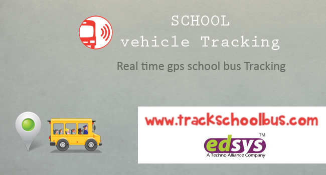
When it comes to the daily and most common applications of GPS, you will find its promising role in tracking school kids, vehicles and even pets. GPS devices are also used to effectively manage a fleet in addition to providing real-time weather updates to anyone concerned.
There are countries that operate through their indigenous GPS systems. 5 of them are India, Russia, China, The European Union and Japan. This post sheds light on all the 5 GPS systems that are operated and managed by these countries.
- NAVIC - India
All thanks to the efforts of Indian Space Research Organization (ISRO), which made India the proud owner of indigenous GPS and navigation system called NAVIC, since 2016. This is the 7th and last navigation satellite launched by India. After the launch of this satellite, India can manage all its military navigation operations without depending on another country.
This is a regional navigation satellite system with 7 satellites working in tandem with each other to provide accurate coordinates of the targeted position. When you say that it is a regional satellite, it means that its real-time timing and positioning operations can span over India and any region in the Indian Territory extending up to 1,500 km.
Applications of NAVIC
- NAVIC can become the leading light for travelers and hikers by providing terrestrial navigation information.
- It can be used to lay hands on accurate location coordinates linked to aerial (air), terrestrial (land) and marine (water) navigation.
- Finding an extensive use in the effective and timely management of disasters, NAVIC can also help in fleet management operation and vehicle tracking.
- Along with providing important data points like precise timing and map coordinates, NAVIC can help you capture land surveying data.
- Additional features include the broadcasting of voice and visual navigation information that can help drivers reach a certain preset destination.
- Galileo - European Union
Getting its name from the well-known Italian astronomer Galileo Galilei, Galileo is a Global Navigation Satellite System (GNSS) that was built by the European Union (EU), in collaboration with the European Space Agency (ESA). It is an interesting piece of trivia to note that this €10 billion project operates through 30 MEO (Medium Earth Orbit) satellites, most of which are operational since 2014.
All the satellites are expected to become fully-functional by 2020. Once the system is completed, Galileo will have 30 satellites which will orbit in space, interoperating with both Russia’s GLONASS and USA’s GPS.
Plan is up for essential lower-precision Galileo services to come with a “cost-free” tag that can be availed by civilians, the high-precision capabilities must be made available to paid commercial consumers. Galileo is supposed to offer vertical and horizontal position measurements with a 1 meter public accuracy.
Additionally, this GNSS project is intended to provide superior positioning services at greater latitudes, when compared to other positioning systems. Italy and Germany are the two companies that are majorly contributing to the Galileo project.
In contrast to the military operations that are directed by the USA’s GPS and Russia’s GLONASS, Galileo is a class apart. The noble intention behind Galileo is to enable civilians make the most of this global positioning system. 2016 was the year in which Galileo started off, by providing basic services, including helping users to be guided by navigation, timing and positioning information.
Applications of Galileo
- The primary objective of Galileo is to offer an exclusive system of high-precision positioning to all the nations conglomerated under the umbrella of European Union. This was a step to avoid relying on GLONASS, the GPS system of Russian, Bei-Dou of China or the United States’ GPS. This was to counter an imminent danger coming from any one of the countries suspending their positioning services to the EU.
- Another important application of Galileo is to come up with a novel global search and rescue (SAR) function, lending a helping hand to all the distressed people caught up in aerial and marine accidents. It is through this GNSS that the time taken to detect an emergency can be brought down to a mere 10 minutes from the earlier timeframe of 3 hours. That means, this facility will come to the rescue of the people in distress, whether they are trapped high up on the mountains or getting pulled into the ebb of deep waters. When it comes to rescue operations, the faster the better. This GNSS meets this pre-requisite of saving the lives of trapped people quickly.
- Certain innovative start-ups and creative companies are deriving the benefits of various applications of satellite data dispersed by the space programs conducted by the EU.
- A constellation refers to the group of satellites that provide information about location. Once all the 30 satellites in the Galileo’s constellation become operational, it will be able to point to users the accuracy of the signals. This is an important data point for scenarios concerning the safety of people. It should also be noted that Galileo’s navigation system provides a medium of two-way communication between the control stations on the ground and the satellites in orbit.
- Last but not the least, Galileo’s positioning functionalities make their strong presence felt in a number of areas including railways, agriculture, ships, autonomous and connected vehicles, drones and Internet of Things (IoT).
- GLONASS - Russia
Commissioned to provide global positioning information to its users since 1995, GLONASS (Global Navigation Satellite) is a Russian space-based satellite navigation system. This system is meant to provide radio navigation satellite services.
Tagged as an alternative GPS service, GLONASS ranks second as the provider of global navigational system services with reasonable precision. If GLONASS is appended to many of the GPS navigation devices, it will favor fixing the positions of built-up areas which obstruct the flow of GPS satellites; accurately and quickly.
While the completion of the GLONASS constellation took place in 1995, the entire constellation turned non-operational by late 1990s with the loss of some satellites. However, under the presidency of Vladimir Putin, GLONASS began to regain its lost glory in the form of increased funding.
And in October 2011, the entire constellation of 24 satellites was reinstated, offering a complete global coverage. All thanks to the changed positioning of the GLONASS satellites, you can enjoy a higher degree of accuracy at high latitudes, far up in the north or south.
Key Applications of GLONASS
- GLONASS combining with the capabilities of GPS finds its application in phone baseband chips sold by well-known vendors like Broadcom, Qualcomm, and Exynos.
- It was in 2011 that Swepos, a network of satellite reference stations of Sweden providing real-time positioning information with meter accuracy was the first overseas company to employ the capabilities of GLONASS.
- Again in 2011, GLONASS made its strong presence felt in the smartphone business. Devices that were launched in 2011 were: Samsung’s Galaxy Note and Galaxy Note II along with Sony Ericsson and Google Nexus 10 incorporated the positives of GLONASS. Tablets and smartphones that were launched in 2011 were in a position to uncover the features of high-degree accuracy and speed locking in challenging conditions.
- Bei-Dou - China
Moving on to the 4th country that operates through its indigenous satellite navigation system, BeiDou Navigation Satellite System is a contribution from China, exclusively for regional coverage. This system operates with two separate satellite constellations.
The first BeiDou system, also known as BeiDou-1 was formally named as BeiDou Satellite Navigation Experimental System. This system operated through 3 satellites that provided restricted coverage along with certain navigation services to the Chinese and the users in neighboring areas.
However BeiDou-1 could not see the light of the day by the end of 2012.
BeiDou Navigation Satellite System (BDS), also known as BeiDou-2 was the name given to the 2nd generation of BeiDou. Colloquially called COMPASS, this system was operational in China since December 2011.
This system had 10 satellites in orbit; a partial constellation. From December 2012 onwards this system offered positioning information to users in the Asia-Pacific region.
It was in 2015 when China started developing its 3rd generation BeiDou system (BeiDou-3) so as to make its presence felt in the global coverage constellation. Until January, BeiDou-3 successfully launched 9 satellites.
However, the target is to launch 35 satellites by 2020, with an aim to provide global positioning services. It should be noted that the BeiDou navigation system has 3 primary advantages when compared to GPS navigation systems for emergencies.
They are two-way communication (bi-directional communication) which is much more secure and highly reliable.
Interesting Applications of Bei-Dou Navigation Satellite System (BDS)
When it comes to creativity, nothing can stop the innate intellect of the Chinese. Here are some exciting applications of Bei-Dou that were churned out by Chinese firms.
- China’s native Bei-Dou navigation system has some interesting uses that can simplify your everyday life. All the way from bank cards to shared bicycles, this navigation system can also help in identifying unmanned patrol vehicles.
- Bank Cards - Most of the modern day bank cards consist of chips which provide the much-needed safety cover against fraudulent monetary transactions. It is through BDS that you will be in a strong position to lay hands on the exact location of every online transaction. Making the most of accurate positioning technology, you can safeguard yourself from online financial frauds.
- Shared Bicycles - Since accurate positioning is significant information to riders of shared bikes, programmed chips employing the capabilities of BDS are being developed.
- The capabilities of BDS can be applied to inspect the performance of all those drivers who have registered to appear for certificate tests.
- The navigation technology can also be used to locate unmanned patrol vehicles in residential areas when they are fitted with monitoring cameras.
- Security guards braving extreme weather conditions can rely on the positioning information shared by BDS.
- Other applications of BDS include: laying of underground pipelines in urban areas and applications connected to the field of agriculture.
- QZSS - Japan
The abbreviation of Quasi-Zenith Satellite System (QZSS) is a Japanese project aimed at developing a four-satellite time transfer system along with a satellite-based augmentation system. Tagged as a regional coverage system, the first trial happened in September 2010 through a demonstration satellite.
The primary aim of QZSS is to offer highly stable and accurate positioning information to the Asia-Oceania region, focusing on Japan. Originally, QZSS was in the hands of the Advanced Space Business Corporation (ASBC).
However, with the dissolution of ASBC in 2007, the commissioning work was transferred to JAXA in tandem with Satellite Positioning Research and Application Center (SPAC) which was set-up in 2007.
It is a known fact that navigation functions facilitate internet browsing through smartphones and car navigation systems through the use of positioning signals coming from satellites.
QZSS humorously named Michibiki (meaning “showing the way” or “guiding”) is meant to do just that so that users can detect the current location using satellite positioning services.
Since most of the satellite positioning services employ the capabilities of USA’s GPS satellites, QZSS will become a four-satellite constellation in 2018 when teamed with GPS.
It is an important piece of information to note that three of QZSS’ satellites can be visible at all times from any of the locations linked to the Asia-Oceania regions. With these visible satellites in place, all those businesses which thrive on spatial and geographical data points can expand and grow.
Proposed Applications of QZSS
- Intending to meet the positioning needs of civilians, Michibiki is aiming to offer a positioning accuracy close to inches.
- As mentioned earlier, satellite geo-location systems will help civilians to carry out internet browsing on their smartphones alongside making car navigation a breeze.
- Japan, a country known for its unforgiving and rough mountains can experience an obstruction to GPS signals. It is for this very reason that QZSS can complement the US operated GPS to provide positioning signals even on mountains.
- Japan has a plan to set-up a constellation of 7 satellites by 2023.
Closing Thoughts
While it is very interesting to note that the GPS of United States of America operates 32 medium Earth Orbit satellites in six different orbits, The USA is a nation that utilizes plenty of resources offered by satellite navigation systems.
Next in line are the 5 countries that were discussed in detail. GPS and GLONASS come across as global navigation systems in which India, Japan and China are the countries that operate regional navigation systems so as to facilitate many businesses in different niches.